consolidated in shapefile format
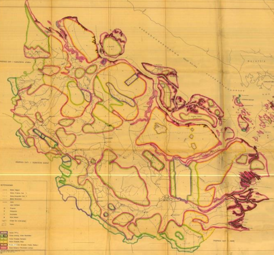
Local Knowledge, Research and Spatial Evidence
Building Riau’s Geospatial Evidence Base
A 2016-2017 collaboration that consolidated 67 geospatial datasets, prepared metadata and applied a forest-area analysis method in Siak and Pelalawan.
Project overview
Project Overview
Hutanriau supported Riau One Map from September 2016 to January 2017 by consolidating 67 geospatial datasets, preparing metadata and developing a forest-area analysis methodology applied in Siak and Pelalawan.
The resulting historical dataset and analyses provided a practical evidence base for discussion on forest governance and land-use planning. They are not current or legally determinative records of boundaries or rights.
Project snapshot
At a glance
included in forest-area analysis: Siak and Pelalawan
prepared on geospatial data conditions and forest-area analysis
developed by Hutanriau for forest-area analysis
Why this work mattered
Project Context
Unclear and inconsistent geospatial information had become a significant obstacle to effective spatial planning, forest governance, and land-use decision-making in Riau.
Government agencies and other institutions maintained different sectoral maps based on different mandates, scales, methods, and policy frameworks. Many maps circulated without adequate information about their source, date, accuracy, or legal status.
These conditions contributed to overlapping permits, unclear administrative boundaries, inconsistencies between provincial and district data, and disputes involving government institutions, private companies, and communities.
The Government of Indonesia had introduced the One Map Policy through Presidential Regulation No. 9 of 2016. WRI Indonesia supported implementation of the policy and provided a sub-grant to Hutanriau to develop geospatial data and institutional engagement in Riau.
The project combined discussion with data custodians, collection and assessment of geospatial information, metadata preparation, and forest-area analysis focused on Siak and Pelalawan.
The work was intended to create a clearer understanding of available data, identify technical and institutional gaps, and strengthen the use of spatial evidence in land and forest governance.
What we set out to do
Objectives
- Consolidate available provincial and district geospatial datasets in a consistent working format.
- Prepare metadata so users could assess the origin, scale and limitations of each dataset.
- Develop and apply a practical method for analysing forest-area data in Siak and Pelalawan.
- Support more informed discussion of forest governance and land-use planning.
Delivery
What Hutanriau Did
- Collected and reviewed spatial data from relevant institutions.
- Standardised 67 datasets in shapefile format.
- Prepared metadata using the Riau One Map approach.
- Assessed the condition and usability of available geospatial data.
- Developed Hutanriau’s forest-area analysis methodology.
- Applied the method in Siak and Pelalawan and prepared analytical reports.
What changed and what we learned
Results and Learning
The project showed that the main challenge was not simply a lack of spatial data. Available datasets were dispersed across institutions, produced at different scales and dates, and often lacked the metadata needed to judge how they could be used.
Consolidating the datasets and preparing metadata made those differences visible. Hutanriau also developed and applied a forest-area analysis method in Siak and Pelalawan, creating a practical basis for more informed discussion of forest governance and land-use planning.
The dataset reflects the 2016-2017 project period and should not be treated as a current or legal determination of boundaries, tenure or rights.
Project album
Field Documentation
Selected photographs documenting project activities, field implementation, and community participation.
Work with us
Planning locally grounded environmental work in Riau?
Hutanriau collaborates with communities, donors, government agencies, research institutions, civil society organisations, and responsible private-sector partners.